Taiwan

Crenulated pelitic schists, MuKua Hsi Valley, Central Range, Eastern Taiwan.
Foto: Kamil Ustaszewski
Coseismic surface displacement caused by the 1999-09-21 M7.3 Chi-Chi earthquake. Guangfu Junior High School, 921 Earthquake Museum, Wufeng, Taichung county, central Taiwan.
Foto: Kamil Ustaszewski
Remote agricultural land in Taiwan's Central Range, east of Puli (Central Taiwan). November 2009.
Foto: Kamil Ustaszewski
Shear zone in Late Cretaceous granitic orthogneiss, Taroko gorge, Central Range, Eastern Taiwan
Foto: Kamil Ustaszewski
Refold structures in calcite marble, Taroko gorge, Eastern Taiwan
Foto: Kamil Ustaszewski
Refold structures in calcite marble, Taroko gorge, Eastern Taiwan
Foto: Kamil Ustaszewski
Shrine of the Eternal Waters, Taroko Gorge, eastern Taiwan.
Foto: Kamil Ustaszewski
The Pacific Ocean along the east coast of Taiwan, looking south towards the city of Hualien.
Foto: Kamil Ustaszewski
Conjugate shear fractures affecting volcanic bombs within Miocene pyroclastic deposits of the Coastal Range, Eastern Taiwan. Coin for scale (bottom center next to the left fracture).
Foto: Kamil Ustaszewski
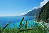
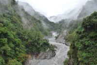
Caution! Objects (in this case geologists) in the mirror may be closer than they appear! Field work along the southern Cross Island Highway near Meishan. From left to right: two unknown geologists from Taipei, Gong-Ruei Ho (NTUT Taipei), unknown geologist, Prof. Wei Lo (NTUT Taipei), Xavier Sengelen.
Foto: Kamil Ustaszewski
Ravi Kanda (left), K. Ustaszewski (third from left) and Xavier Sengelen (second from right, crouching) with four statues of unnamed Taiwanese aboriginal hunters, near Baolai, southern Cross Island Highway. October 2010.
Foto: Kamil Ustaszewski
Clouds over Hsin1 Gu3 Lu2 Hsi1, near Xiama, southern Cross Island Highway, Eastern Taiwan, November 2010.
Foto: Kamil Ustaszewski